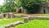
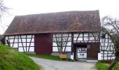
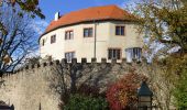
![](/images/other/stat-length.png)
![Randonnée A pied Reichelsheim (Odenwald) - Rundwanderweg Reichelsheim 1: Sagenweg Wildweibchenstein - Photo](https://media.geolcdn.com/t/1900/400/91045a8f-f72a-4ffd-b179-1e5e0e95bc15.jpeg&format=pjpeg&maxdim=2)
Rundwanderweg Reichelsheim 1: Sagenweg Wildweibchenstein
SityTrail - itinéraires balisés pédestres
Tous les sentiers balisés d’Europe GUIDE+
![Longueur](/images/other/stat-length.png)
Longueur
12 km
![Altitude max](https://static1.geolcdn.com/siteimages/upload/files/1508320355ic_sort_altitude_max_24dp.png)
Altitude max
426 m
![Dénivelé positif](https://static1.geolcdn.com/siteimages/upload/files/1508320355ic_sort_den_pos_24dp.png)
Dénivelé positif
339 m
![Km-Effort](/images/other/stat-length.png)
Km-Effort
16,5 km
![Altitude min](https://static1.geolcdn.com/siteimages/upload/files/1508320355ic_sort_altitude_min_24dp.png)
Altitude min
211 m
![Dénivelé négatif](https://static1.geolcdn.com/siteimages/upload/files/1508320355ic_sort_den_neg_24dp.png)
Dénivelé négatif
339 m
![Boucle](https://static1.geolcdn.com/siteimages/upload/files/16400158638029165_repeat_loop_refresh_sync_direction_icon.png)
Boucle
Oui
Balise
Date de création :
2022-02-11 16:21:21.518
Dernière modification :
2022-02-11 16:21:21.518
![A pied](https://static1.geolcdn.com/sitytour/trail-icons/100.png)
3h44
Difficulté : Facile
![Scannez ce code QR pour ouvrir la randonnée dans l'application SityTrail](https://capi.geolives.com/qq0zvz2zws4bq2lad0pu/sitytour/trails/3096197/qr.png?size=200)
Application GPS de randonnée GRATUITE
À propos
Randonnée A pied de 12 km à découvrir à Hesse, Odenwaldkreis, Reichelsheim (Odenwald). Cette randonnée est proposée par SityTrail - itinéraires balisés pédestres.
Description
Randonnée créée par Odenwaldklub.
Symbole: grünes Kreissegment, oben offen. In der Öffnung R, in der Mitte eine 1
Localisation
Pays :
Allemagne
Région :
Hesse
Département/Province :
Odenwaldkreis
Commune :
Reichelsheim (Odenwald)
Localité :
Unknown
Départ:(Dec)
Départ:(UTM)
487594 ; 5507287 (32U) N.
Commentaires
Randonnées à proximité
![Randonnée A pied Brensbach - Rundwanderweg Brensbach, Wildgehege 5: Affhöllerbach-Weg - Photo](https://media.geolcdn.com/t/375/260/65cd9644-8fb8-496d-a306-d161297ce940.jpeg&format=jpg&maxdim=2)
![A pied A pied](https://static1.geolcdn.com/sitytour/trail-icons/100.png)
Rundwanderweg Brensbach, Wildgehege 5: Affhöllerbach-Weg
A pied
Facile
Brensbach,
Hesse,
Odenwaldkreis,
Allemagne
![](/images/other/stat-length.png)
5,8 km | 8 km-effort
1h 48min
![](https://static1.geolcdn.com/siteimages/upload/files/16400158638029165_repeat_loop_refresh_sync_direction_icon.png)
Oui
![Randonnée A pied Reichelsheim (Odenwald) - Rundwanderweg Vierstöck 6: Knösberg-Weg - Photo](https://media.geolcdn.com/t/375/260/83832b04-129c-42f4-8f47-3dfb605b5b7f.jpeg&format=jpg&maxdim=2)
![A pied A pied](https://static1.geolcdn.com/sitytour/trail-icons/100.png)
Rundwanderweg Vierstöck 6: Knösberg-Weg
A pied
Facile
Reichelsheim (Odenwald),
Hesse,
Odenwaldkreis,
Allemagne
![](/images/other/stat-length.png)
3,3 km | 4,5 km-effort
1h 0min
![](https://static1.geolcdn.com/siteimages/upload/files/16400158638029165_repeat_loop_refresh_sync_direction_icon.png)
Oui
![Randonnée A pied Lindenfels - Rundwanderweg Lindenfels Weinweg 1: Ludwigsfelsen-Weg - Photo](https://media.geolcdn.com/t/375/260/c9a007a5-ee92-483f-adca-742cc86922c5.jpeg&format=jpg&maxdim=2)
![A pied A pied](https://static1.geolcdn.com/sitytour/trail-icons/100.png)
Rundwanderweg Lindenfels Weinweg 1: Ludwigsfelsen-Weg
A pied
Facile
Lindenfels,
Hesse,
Kreis Bergstraße,
Allemagne
![](/images/other/stat-length.png)
3,1 km | 4,6 km-effort
1h 3min
![](https://static1.geolcdn.com/siteimages/upload/files/16400158638029165_repeat_loop_refresh_sync_direction_icon.png)
Oui
![Randonnée A pied Reichelsheim (Odenwald) - Geo-Lehrpfad Ober-Kainsbach : Baustein, Erz und schwerer Spat (rot) - Photo](https://media.geolcdn.com/t/375/260/65cd9644-8fb8-496d-a306-d161297ce940.jpeg&format=jpg&maxdim=2)
![A pied A pied](https://static1.geolcdn.com/sitytour/trail-icons/100.png)
Geo-Lehrpfad Ober-Kainsbach : Baustein, Erz und schwerer Spat (rot)
A pied
Facile
Reichelsheim (Odenwald),
Hesse,
Odenwaldkreis,
Allemagne
![](/images/other/stat-length.png)
3,5 km | 5,8 km-effort
1h 18min
![](https://static1.geolcdn.com/siteimages/upload/files/16400158638029165_repeat_loop_refresh_sync_direction_icon.png)
Non
![Randonnée A pied Lindenfels - Rundwanderweg Lindenfels Weinweg 4: Gersprenzquellen-Weg - Photo](https://media.geolcdn.com/t/375/260/fcc592b3-114d-496d-8742-ccf97edd0502.jpeg&format=jpg&maxdim=2)
![A pied A pied](https://static1.geolcdn.com/sitytour/trail-icons/100.png)
Rundwanderweg Lindenfels Weinweg 4: Gersprenzquellen-Weg
A pied
Facile
Lindenfels,
Hesse,
Kreis Bergstraße,
Allemagne
![](/images/other/stat-length.png)
3,3 km | 4,4 km-effort
1h 0min
![](https://static1.geolcdn.com/siteimages/upload/files/16400158638029165_repeat_loop_refresh_sync_direction_icon.png)
Oui
![Randonnée A pied Fischbachtal - Rundwanderweg Fischbachtal Gagernstein 3: Daumensteinrundweg - Photo](https://media.geolcdn.com/t/375/260/da816d37-44a7-420a-ad00-1eb7ad6875df.jpeg&format=jpg&maxdim=2)
![A pied A pied](https://static1.geolcdn.com/sitytour/trail-icons/100.png)
Rundwanderweg Fischbachtal Gagernstein 3: Daumensteinrundweg
A pied
Facile
Fischbachtal,
Hesse,
Landkreis Darmstadt-Dieburg,
Allemagne
![](/images/other/stat-length.png)
4,2 km | 6,4 km-effort
1h 26min
![](https://static1.geolcdn.com/siteimages/upload/files/16400158638029165_repeat_loop_refresh_sync_direction_icon.png)
Oui
![Randonnée A pied Modautal - Rundwanderweg Fischbachtal 4: Steinau Weg - Photo](https://media.geolcdn.com/t/375/260/da816d37-44a7-420a-ad00-1eb7ad6875df.jpeg&format=jpg&maxdim=2)
![A pied A pied](https://static1.geolcdn.com/sitytour/trail-icons/100.png)
Rundwanderweg Fischbachtal 4: Steinau Weg
A pied
Facile
Modautal,
Hesse,
Landkreis Darmstadt-Dieburg,
Allemagne
![](/images/other/stat-length.png)
5,4 km | 8 km-effort
1h 49min
![](https://static1.geolcdn.com/siteimages/upload/files/16400158638029165_repeat_loop_refresh_sync_direction_icon.png)
Oui
![Randonnée A pied Fränkisch-Crumbach - Rundwanderweg Am Michelbacher Tal 5 : Rund um den Galgenbergweg - Photo](https://media.geolcdn.com/t/375/260/61f3a240-0d63-4e0e-bbfe-6da5694e8c0d.jpeg&format=jpg&maxdim=2)
![A pied A pied](https://static1.geolcdn.com/sitytour/trail-icons/100.png)
Rundwanderweg Am Michelbacher Tal 5 : Rund um den Galgenbergweg
A pied
Facile
Fränkisch-Crumbach,
Hesse,
Odenwaldkreis,
Allemagne
![](/images/other/stat-length.png)
3,6 km | 5 km-effort
1h 8min
![](https://static1.geolcdn.com/siteimages/upload/files/16400158638029165_repeat_loop_refresh_sync_direction_icon.png)
Oui
![Randonnée A pied Reichelsheim (Odenwald) - Rundwanderweg Reichelsheim Totenkirche 4: Panorama-Weg - Photo](https://media.geolcdn.com/t/375/260/4a29ddc6-2412-4546-b755-b9a2bdce046f.jpeg&format=jpg&maxdim=2)
![A pied A pied](https://static1.geolcdn.com/sitytour/trail-icons/100.png)
Rundwanderweg Reichelsheim Totenkirche 4: Panorama-Weg
A pied
Facile
Reichelsheim (Odenwald),
Hesse,
Odenwaldkreis,
Allemagne
![](/images/other/stat-length.png)
5,7 km | 8,2 km-effort
1h 51min
![](https://static1.geolcdn.com/siteimages/upload/files/16400158638029165_repeat_loop_refresh_sync_direction_icon.png)
Oui